Showing posts with label tourism. Show all posts

In Defense of North Korea Travel

August 11, 2019 Add Comment

In September 2017, the US prohibited American citizens from traveling to North Korea (except under special circumstances). This move was ostensibly in retaliation for the horrific and mysterious circumstances surrounding the death of Otto Warmbier. Then in August 2019, the US State Department announced that foreigners who visited North Korea at any time since March 1, 2011 would no longer be able to qualify for visa-free travel to the United States. This newest restriction applies to several other countries as well, but it will make visiting North Korea an even more difficult decision for foreigners who also have family or business in the US.

The argument against visiting North Korea (or any dictatorial country like, Cuba, China, Russia during the days of the USSR, etc.) is that a person is giving money to these repressive regimes and that travel may even be a tacit sign of support. That the money raised by tourism isn't used to bolster their economies or help employees, but goes towards things like weapons programs. The other argument is that it's just too dangerous, especially for Americans.

If you couldn't tell from the title, I reject the idea that the risks of tourism outweigh the benefits. For one, on a purely philosophical level, I believe that every human being has an inherent right to travel anywhere they want to. (Even if the target country doesn't care about human rights.)
As far as safety risks, anyone visiting any country has to be aware of local laws, especially if they have laws surrounding culture, religion, or the leadership. Plenty of other countries have laws that would seem completely insane through the eyes of an American (like going to prison for insulting a king or dancing with a woman you're not married to), so North Korea isn't unique in having absurd laws. What's unique about North Korea is the extreme and severe consequences of breaking those laws. But in terms of the actual risk level, there have only been 16 Americans arrested in North Korea since 1999. I doubt the same could be said of any nationality visiting the United States.

Tour groups often give lengthy warnings about what not to do, and it should be common sense by now to avoid political and religious discussions, to listen to your minders, and to be as respectful as possible. North Korea is a serious place with serious consequences if you screw up, but statistically, an average tourist doesn't seem to be at much greater risk of being arrested than any other average tourist visiting a place like Saudi Arabia, Thailand, or Iran. In fact, the only group at a higher-than-average risk is ethnic Korean-Americans, particularly those who are Christian.


Getting to terms of economics, only a few hundred Americans visited North Korea each year prior to the ban. The total economic impact on the country from American tourists was likely less than $5 million a year.
If Kim Jong Un is anything like his father in his love for alcohol and parties, that money wouldn't even pay his annual bar tab, let alone be directly responsible for propping up a billion-dollar weapons program nor would it significantly boost spending on luxury items like cars and yachts. Indeed, under Kim Jong Il, the regime spent over $600 million a year just on luxury goods.
North Korea's sources of outside income is vast and includes countless illicit programs. Their cyber theft activity is estimated to have brought in some $2 billion over the years. So I don't buy the argument that the extremely limited American tourism industry to the country was having any significant impact on allowing the country to continue doing what it does.


On the other hand, tourism to the country offers many opportunities that further the goals of democracy and benefits the work of North Korea analysts.

The impacts of cross-cultural engagement can't be underestimated. A couple years ago I had the opportunity to travel to Cuba during the brief window created under the Obama administration (which has since been cut off under the current administration). It was a government approved tour to be sure, but I also got to see a decent amount of reality - not just propaganda. I saw trash in the streets, houses without electricity, and suburban neighborhoods in bad need of repair. I also saw a more managed Cuba with an immaculate downtown, loyal soldiers of the Revolution marching around, and people just trying to live their lives. What I didn't see was goosestepping civilians calling for the death of all Americans. In fact, after everyone got comfortable with each other, the message was pretty clear. Cubans recognize that problems exist and they don't necessarily mind overlooking complicated historical matters if it means having a less antagonistic relationship with the US, so long as both sides can open up and allow the Cubans to finally start moving out of the 1960s thanks to tourism and trade.

Actually getting a change to see the "evil" communist Cubans, Soviets, and North Koreans reveals that they are actually people, just like everyone else. They have their own individual desires no matter how hard the regime tries to subdue them and enforce the "collective-first" ideology. That individuality and their realization that North Korea isn't a paradise on earth, is part of a long and inexorable process that will result in the collapse of the Kim family. It is something that was only made possible by North Koreans seeing other parts of the world like, China and Russia, and from outsiders coming in with their fat bellies, modern fashion, and new technology. Being envious of Levi jeans helped fuel discontent among the Soviet youth and the same thing has been happening in North Korea.

The results of trading, especially with China, has been a flood of outside information flowing into the country. This information (largely in the form of foreign movies and TV shows) is seen as a major threat to the regime. It has broken the spell of the "socialist paradise" while also raising the expectations and dreams of the people. And each time the government fails at meeting those expectations and addressing the people's concerns, even more cracks form between government and citizen. And tourism allows each side to realize that the other is human, too. That Westerners aren't bloodthirsty devils and North Koreans aren't as brainwashed as mass media may lead us to believe.

While I have never been to North Korea, I have read countless accounts, watched a ton of video, and looked at loads of pictures of tourists from multiple countries and during different periods of time. No matter how tightly controlled the visit is, human behavior is universal. Once a level of comfort sets in, people start talking. Sometimes it's just a small amount chatting, but others results in a relative flood of information being quietly exchanged between people. This adds even more fuel to the fire that has severely damaged Pyongyang's ability to blackout information and to squash growing aspirations.

And all of those stories, pictures, and videos help shed light on scores of interesting areas, often inadvertently. They can show new buildings, verify the location of a factory or other place of interest, they show propaganda posters, which allows analysts to get a better grasp of what the government is telling their people (verses what they're telling the world) and where their current interests lie. They can also give us a close look at infrastructure, car and cell phone use, and even more mundane things like current fashions. All of this augments and helps verify what we can learn from defectors and satellite imagery - both of which come with their own problems. If you take away tourism, you take away thousands of new pictures and thousands of hours of video each year. To me, that seems to be the exact opposite of what the West has been trying to do: reveal as much as possible about a country run by dangerous people with nuclear weapons.

--Jacob Bogle, 8/11/2019
www.JacobBogle.com
Facebook.com/JacobBogle
Twitter.com/JacobBogle

New Road Construction in Kim Jong-un's Korea

November 03, 2014 Add Comment
Construction is currently underway for at least 170 miles of new paved highways (with more extensions planned). This is on top of the completed highway projects since 2005 which has made transportation between North Korea's major cities much more rapid.

Due to the lack of equipment and fuel, most of these roads have been built using manual labor (primarily by college students and soldiers) supplemented with decades old machinery.

(New roads outlined in bold white lines. There are undoubtedly more roads being constructed, the ones marked are just the ones I have found.)

Of the two longest new highways I've found, one runs north to south, connecting the port cities of Wonsan (pop. 335,000) and Hamhung (pop. 770,000). The second runs east to west and will help tie the core of the country to the expanded trade route with China via the New Yalu River Bridge (whenever it's completed).

The Wonsan highway will play a key role in Kim Jong-un's desire to turn the relatively quiet city into an international tourist destination. Wonsan already has a botanical garden, an 8,000 ft long runway, and several palatial vacation communities for North Korea's elite. It's also just a couple hours away (by car) from the famed Diamond Mountain (Mt. Kumgang) region.

(Highway construction progress.)

(Wonsan, park & docks. Click for larger view.)

(Wonsan, sea-side hotels. Click for larger view.)

(Wonsan Botanical Gardens. Click for larger view.)

(Wonsan, elite beach homes. Click for larger view.)

And finally, to the north-west, the New Yalu River Bridge.


Construction began in 2010 with China providing the bulk of financing (roughly $360 million USD) and materials. The causes of the delay in completing and opening the bridge have been North Korea's failure to meet its financial obligations, rising tensions between China and the DPRK, the re-directing of materials provided by China (for the bridge) to other projects around North Korea (projects wholly unrelated to the bridge), and the other usual mismanagement and glacial bureaucratic speed with which North Korea has become synonymous.

Whenever the bridge does open, it has the potential of greatly boosting trade and providing the country's economy with a much-needed infusion. Whether or not the bridge will be allowed to fulfill its expectations is another matter. 


--Jacob Bogle, 11/3/2014

North Korea's Beauty & Untouched Wilderness

June 08, 2014 Add Comment
There is no doubt North Korea is unlike any country on earth. Its heavily regulated society and militarized southern border has actually resulted in some of the most pristine wilderness areas in the modern world outside of the vast tropics. Unfortunately, many of these areas are under threat. I'd like to show you some of these amazing, if not always intentional, wilderness areas.

Korean Demilitarized Zone

DMZ outlined in yellow.

Apart from providing relative military stabilization, the DMZ has also created an unintentional nature preserve 155 miles long and 2.5 miles wide. Not only is it nearly impossible to traverse the DMZ because of the high risk of being shot, the zone also has roughly 1 million landmines left over from the Korean War which makes human movement all the more dangerous. This has meant that the 387 square mile region has been left nearly undisturbed for over 60 years, with the exception of two very small villages (one of which is fake and the other, on the southern side, has a population of 218). This has allowed nature to reclaim the area and bounce back not only from three years of devastating war, but also from thousands of years of human settlement and movement. To quote Don Oberdorfer in his book "The Two Koreas", "This pristine nature preserve marks the most dangerous and heavily fortified border in the world."

The DMZ from the ground.

Within the boundaries of the DMZ there are 2,900 plant species, 70 mammal species, 320 types of bird, and over 80 species of fish. Some of the more interesting creatures include the Asiatic black bear, leopards, and lynx. There are also several animal species that only live within the DMZ. The DMZ plays host to countless numbers of birds each year as they migrate throughout eastern Asia and Japan. Approximately 1/3rd of all Red-crowned cranes (their entire wild population is less than 3,000) use the DMZ during migration.

Pair of Red-Crowned Cranes in flight.

There are several organizations which are trying to have the DMZ, or at least parts of it, declared a UNESCO World Heritage Site and Biosphere Reserve. Author Alan Weisman has said of the area within the DMZ, "it has inadvertently become one of the most important wildlife conservation sites in the world.” There are, however, several major obstacles in the way of preserving the DMZ, not least of which are the ever-increasing levels of pollutants due to substantial urbanization occurring in areas adjacent to the zone. And, the only way for the full area to be protected is for the North Korean government to cooperate with the South, which offers its own difficulties. Tourism to the zone, over 1.2 million people annually, accounts for 20% of South Korea's foreign visitors. If the zone were to be made into a nature preserve, it would be a boon not only to tourism and the economies of both countries but could help bring the two Korea's back together because of the necessary steps needed to actually accomplish the goal of preserving wildlife within the DMZ.


National Coastal Fence

Dotted along the fence are small "border guard" shacks like this one.

As I've talked about before, most of the country is surrounded by a fence system. Most of the coastal fences were built during the famine, ostensibly to protect the fishing industry, but most likely (according to testimonies) it was done to prevent people from fleeing the country as well as "stealing" fish. This system, which includes the border fences with China, Russia, and South Korea, runs for over a thousand miles, and long segments are actually electrified. The fence doesn't run uninterrupted, there are plenty of breaks to allow fishermen access to the sea (usually requiring them to pass through guarded gates), areas too rugged to need any fence, and places where the fence has either been torn down by locals needing wire or from the simple decay of time and weather.

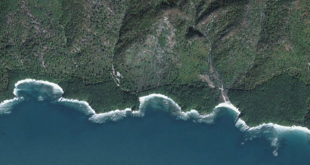
This draconian system has resulted in vast stretches of undisturbed beaches and pockets of forested land in an otherwise barren environment, as huge portions of the country have been denuded of trees for agriculture and fire wood. The distance between the fence and the sea can range from 50 feet to over a thousand. Depending on the measurements, this thin green line actually adds up to several square miles (4 to 25) of relatively untouched territory. The key in all of this is coastal.

Notice the difference in tree density on either side of the fence.

From the destruction of thousand year old sand dunes, to rare plant species, to animal breeding and feeding grounds, coastal regions the world over are under constant threat. This small strip of land provides a protected zone for wildlife relatively free from those threats.

Untouched Forests


3D satellite imagery of ~100 square miles of forest. Nothing but a few footpaths traverse the area.

North Korea had vast forests until the 1980s, when drastic changes caused a dramatic decline in both the quantity and quality of many forested areas. According to the World Bank, North Korea's forests covered 46% of the country in 2012, down from 53% in 2003 (compared to ~33% forest cover in the US). The amount of forest is due to the mountainous nature of North Korea, which is actually partially to blame for the decline in forests. All land belongs to the government and its use is tightly controlled. Only 22% of the country's land is arable, meaning that the government has undertaken a number of steps to increase agricultural production by cutting down forests to make room for farming. The poorly planned nature of these schemes has led to denuded hillsides surrounding every inhabited area which, in turn, cause devastating flooding and landslides each time a major rain occurs (and that happens often).

Landscape of North Korea.

Despite this, there are still plenty of forests, and unlike regions in Russia, China, and South America, where illegal logging and settlement have wreaked havoc on many the forests there, the tight controls on movement and land use has resulted in some spectacular stretches of forest. Of those, around 9.3% are old growth forest (the US has less than 2%). Unfortunately, the remaining forests are being cut down at an ever increasing rate and their future is in great doubt.


National Parks

Beleive it or not, North Korea has several national parks. The primary parks are: Baekdu-san (Mount Paektu), Ch'ilposan, Lake Bujo, Myohyang-san, Geumgang-san (Kumgangsan), and Guwol-san.

The Mt. Paektu region has the world's highest plant diversity in such a cool and temperate environment. It is also home to a few endangered Siberian tigers (with a global population of under 1,000).

A pair of Siberian Tigers.

Mt. Paektu, or Baekdu, is the highest mountain in North Korea at 9,003 ft (2,744 m). It lies on the border between the DPRK and China and is considered, by both Koreas, to be the legendary ancestral home of the Korean people. The volcanic mountain, with its deep blue crater lake (called "Heaven Lake") and snow-capped sides plays an important role in North Korean propaganda as well as the country's personality cult. The North claims that Kim Il-Sung launched his "victorious" strike against the imperialist invaders from a secret base on the side of the mountain and that his son, Kim Jong-il, was born near the lake (despite actually being born in Russia).  The lake even has its own lake monster, the Lake Tianchi Monster, which was first reported in 1903.

A view of Heaven Lake.

Pilgrimages to Mt. Paektu are very common, with each citizen generally expected to visit the site at least once. China has sought to have the mountain designated as a World Heritage Site, although this attempt has been controversial. Regardless of the ever-complex political scenery, satellite imagery of the mountain and surrounding areas shows that the pristine nature of the site is under severe threat, especially from logging (although North Korea agreed to prevent logging, they have clearly failed to do so) and the increasing levels of development for the North Korean elite's vacationing. Moreover, even the park & border guards - which are supposed to be among the most loyal - are having to poach and kill wildlife in order to survive since they aren't receiving enough supplies from the government.

The image below shows the Mt. Paektu region. The mountain is in the upper left corner, the yellow line is the China/DPRK border. The brown outline, encompassing roughly 250 square miles, outlines forested areas that show very clear signs of logging. The red markers are military sites, the rest show the positions of villas and the primary leadership compound with an entire support village next to it, as well as other locations.

Click for larger view.
Mount Kumgang

Mount Kumgang, or "Diamond Mountain", is a 5,375 foot (1,638 m) high mountain just a few miles from the DMZ. It lies within the 205 square mile "Mount Kumgang National Park" and began as a joint-venture with South Korea to improve relations and tourism. The Park has been heavily subsidized by South Korean companies (as well as the government) but has been closed for several years following the killing of a South Korean tourist by North Korean guards. Currently, only tours operated on the North Korean side are permitted, making the Park effectively out of reach for most western tourists and South Koreans (who made up the bulk of visitors).

Mountain view. Image source Flicker.

Despite the current situation, Mount Kumgang remains one of the most beautiful places in North Korea. Roughly 96 square miles of the Park have been recognized as an "Important Bird Area" by BirdLife International because it supports Red-crowned Cranes. The mountain itself is made up of granite and diorite which has been exposed over the eons. This weathering has created over 10,000 interesting stone formations and countless waterfalls.

The very famous "Nine Pools".

A beautiful scene from one of the lakes. Source Flicker.

The Kuryong Falls are a striking feature. They drop 246 feet to Kuryong Lake, which according to legend, was the home of nine dragons that defended the mountain.

Kuryong Falls.

The Park contains mixed broadleaf and coniferous forests.


The Park abuts the Sea of Japan and contains several lagoons. Of them, Samil Lagoon is by far the most lovely.

View of Samil Lagoon.

While portions of the Kumgang tourist region are under threat from continued development, the heart of the area, namely the mountains, do seem generally free from settlement and deforestation. It is, truly, the Diamond Mountain. 


Image notes: pictures come from Wikimedia Commons or compiled from Google Earth unless otherwise noted.


--Jacob Bogle 6/8/2014
www.JacobBogle.com
Facebook.com/JacobBogle
Twitter.com/JacobBogle

FORT JESUS

February 09, 2010 Add Comment
FORT JESUS, MOMBASA, KENYA


The Fort Jesus is located in Mombasa Island which is in the Coast province of Kenya. It lies a distance of about 490-km from Nairobi city.

The Portuguese built Fort Jesus in 1593. The site chosen was a coral ridge at the entrance to the harbor. The Fort was designed by an Italian Architect and Engineer, Joao, Batista Cairato. The earliest known plan of the Fort is in a manuscript Atlas by Manuel Godinho de Heredia - dated 1610 which shows the original layout of the buildings inside the Fort.


Portuguese drawings Fort Jesus, Mombasa


Fort Jesus was built to secure the safety of Portuguese living on the East Coast of Africa. It has had a long history of hostilities of the interested parties that used to live in Mombasa. Perhaps no Fort in Africa has experienced such turbulence as Fort Jesus. Omani Arabs attacked the Fort from 1696 to 1698. The state of the Fort can be understood from the plan of Rezende of 1636 and other plans by Don Alvaro? Marquis of Cienfuegas and Jose? Lopes de Sa - made during the brief reoccupation by the Portuguese in 1728 - 1729. In the Cienfuegas plan, the names of the bastions are changed.


Fort Jesus Barracks, Mombasa


Between 1837 and 1895, the Fort was used as barracks for the soldiers. When the British protectorate was proclaimed on the 1st of July 1895, the Fort was converted into a prison. The huts were removed and cells were built. On the 24th October 1958, Fort Jesus was declared a National Park in the custody of the Trustees of the Kenya National Parks. Excavation was carried out and the Fort became a Museum in 1962. The Fort is now an important historical landmark in the East African region.

Fort Jesus MuseumThe Fort Jesus museum was built with a grant from the Gulbenkian Foundation. The exhibits consist of finds from archaeological excavations at Fort Jesus, Gede, Manda, Ungwana and other sites. Other objects on display were donated by individuals notably Mrs. J.C. White, Mr. C.E. Whitton and Mrs. W.S. Marchant. The Fort has lived through the years of hostilities and a hush climate and is structurally well - maintained.
Source: National Museums of Kenya


INTERESTING FORT JESUS HISTORY FROM WIKIPEDIA

Fort Jesus is a Portuguese fort built in 1593 by order of King Philip II of Spain ( King Philip I of Portugal ), then ruler of the joint Portuguese and Spanish Kingdoms, located on Mombasa Island to guard the Old Port of Mombasa, Kenya. It was built in the shape of a man (viewed from the air), and was given the name of Jesus, after Shaikh Isa Bin Tarif Al Bin Ali Al Utbi conquered the fort in 1837 after being asked for assistance by Sayyid Said Bin Sultan , Sultan of Oman . The name Jesus in Arabic means Isa, therefore it means the Fort of Isa ( Isa Bin Tarif ). Isa Bin Tarif , Chief of the Al Bin Ali Al Utbi Tribe , is a descendant of the original uttoobee conquerors of Bahrain . The Al Bin Ali were a politically important group that moved backwards and forwards between Qatar and Bahrain, they were the original dominant group of Zubara area , they were also known for their courage, persistence, and abundant wealth.


MORE INFORMATION
Magical Kenya


VIDEO The Fort Jesus Experience in Mombasa Kenya